Death to Google Ads! Texans Talk Tip Jar! 🍺😎👍
Thanks for your support!

2012 Hurricane Season

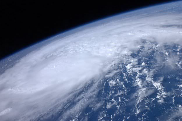
Tropical Storm Emily has formed over the Lesser Antilles. Emily is expected to move over Hispanola within the next 48 hours, then head over the Bahamas. Current forecast tracks have Emily making landfall on the east-central Florida coastline this weekend, possibly as a cat-1 hurricane. The storm's development greatly depends on interaction with land masses over the next few days, and may strengthen at times to hurricane status. After approaching Florida, Emily may follow the southeast U.S. coast northwards to the Outer Banks over the weekend and into early next week.

at201105_5day.gif

Emily was shredded over the Hatian mountains.
 
There are currently 3 areas of interest, along with a tropical depression, in the North Atlantic basin. Of these systems, only one has a decent chance of impacting the U.S. within the next couple weeks, and this system won't be moving into the eastern Caribbean for several days.
 
There are currently 3 areas of interest, along with a tropical depression, in the North Atlantic basin. Of these systems, only one has a decent chance of impacting the U.S. within the next couple weeks, and this system won't be moving into the eastern Caribbean for several days.

Plant one right over Austin my man. :fans: If I see a newsman/woman tell me to drink plenty of liquids like I'm 10 one more time.............:wild:
 
Damn, you made me check. There are actually four advisories out right now for the Atlantic, none of which look worrisome for us. Of course that means jack squat when it comes to weather.
 
Tropical Storm Gert brushed against Bermuda earlier today, and now eyes are set on Invest 93, which is currently over the Lesser Antilles. While development is not expected within the next day or so, this system will enter a more favorable environment Wednesday.
 
Tropical Storm Gert brushed against Bermuda earlier today, and now eyes are set on Invest 93, which is currently over the Lesser Antilles. While development is not expected within the next day or so, this system will enter a more favorable environment Wednesday.

Is it headed to East coast, Midwest or Florida?
 
I think we should all just move to Seattle with Brakos!! Rain, temps in the 70s ALL THE FRIGGIN SUMMER, beautiful area, etc!! BUT, no Texan football!! Guess I'll just have to sweat it out!!:smiliepalm:
 
I think we should all just move to Seattle with Brakos!! Rain, temps in the 70s ALL THE FRIGGIN SUMMER, beautiful area, etc!! BUT, no Texan football!! Guess I'll just have to sweat it out!!:smiliepalm:
:lol: Just wait till November.... then I get to brag to the midwest/northeast states. :)
 
Today marks 12th day in a row in 70s for Seattle, and 21st of last 23 days. Now that's a weather pattern to get stuck in! :tease:
 
Well, some hurricane season huh? I think I might have felt a slight breeze today from the coastal area, maybe a storm is brewin'.
 
Tropical Storm Harvey continues to batter Honduras with heavy rainfall... the storm's center is off-shore, and development to minor hurricane status is possible before moving over Central America tomorrow... Harvey will not be a threat to the U.S.

Invest 97 is currently expected to develop over the next day or so... model tracks point I-97 through the Caribbean islands of Puerto Rico, Hispanola, and Cuba... before exiting into the eastern Gulf of Mexico. How much interaction I-97 has with these islands will determine its condition in the gulf... I-97 is expected to move in GOMEX around Wednesday.

Two areas of interest in the Cape Verdes... looking very disorganized... will not develop anytime soon.
 
Invest 97 has now become Tropical Storm Irene... tied for 2nd-earliest 9th named storm (tie 1936, 2005)... currently impacting the Antilles. Irene may become hurricane before interaction with Hispanola and Cuba... expected to be tropical storm moving over Florida keys Thursday, but forecast very uncertain... if Irene enters the Gulf or open Atlantic, she could restrengthen and become a hurricane.

at201109_5day.gif

Hopefully it will curve into the Atlantic and miss Florida.
 
What could be considered worst-case scenario for the southeast Atlantic coast has just happened.... the center of Hurricane Irene will miss Hispanola. Irene took a northerly trend to the north of the island overnight, and is now sitting about 75 miles north of the eastern tip of the island. Irene is currently forecasted to be a major hurricane as it skirts the Florida peninsula and heads towards South Carolina.
 
What could be considered worst-case scenario for the southeast Atlantic coast has just happened.... the center of Hurricane Irene will miss Hispanola. Irene took a northerly trend to the north of the island overnight, and is now sitting about 75 miles north of the eastern tip of the island. Irene is currently forecasted to be a major hurricane as it skirts the Florida peninsula and heads towards South Carolina.

So its looking like it misses South Florida and will instead hit the Carolinas?
 
So its looking like it misses South Florida and will instead hit the Carolinas?

Yep. The steering trough is moving into position earlier than originally expected... and with Irene's recent intensification (now a cat-2), we could see a path more towards North Carolina.
 
If its anywhere close to a 3 at landfall its going to be bad. But at least you will see Stephanie Abrams in a tight t-shirt on some beach somewhere.

Abrams+then+1+version+2.0.jpg
 
The projected path (which changes daily, of course) now has it hitting NY city as a cat 1. If that happens, we'll be hearing about this for years.
 
Yep. The steering trough is moving into position earlier than originally expected... and with Irene's recent intensification (now a cat-2), we could see a path more towards North Carolina.

It looks like Florida is not gonna get hit, but I imagine Florida will get some rain though, right?
 
It looks like Florida is not gonna get hit, but I imagine Florida will get some rain though, right?

The East coast of Florida will likely get an outer rain band, and plenty of high surf as well... probably not much more than everyday thundershowers there.

Also, after dusting off the cobwebs I found Irene's ancestor from 1821.
 
did this have anything to do with what hit houston last night? the rainfall was fairly weak here in katy, but it's been a while since i've seen such a lightning storm.
 
****, I am flying into JFK on Saturday (not a problem), and have a flight to Columbus at 7:30 PM (could be a problem). What are the odds my flight gets cancelled?
 
****, I am flying into JFK on Saturday (not a problem), and have a flight to Columbus at 7:30 PM (could be a problem). What are the odds my flight gets cancelled?

It's likely you'll have problems leaving JFK... once Irene goes extra-tropical (which will happen not long after NC landfall) the storm will be accelerating northwards to NYC and could hamper travel well before the center of Irene's arrival... best bet is to check with your airline, many are offering waivers for flight change fees.

Quick check online at the JFK airport is that almost all Saturday flights will be delayed or cancelled.

http://online.wsj.com/article/SB10001424053111904787404576530680544194282.html
 
I hope the NYC has its subway pumps and tunnel seals fully functioning, otherwise that amount of water is going to cause a world of hurt.
 
The places in the path of Hurricane Irene are supposed to get up to 10 inches of rain. Damnit, we need that! It needs to make a U-turn.
 
Folks in NY are tripping the hell out, like theres a nuke on the way....rookies. :hankpalm:

I keep telling my wife that. She just rolls her eyes because she thinks my bitching about the east coast bias covers all aspects of life and not just sports. (She's from upstate NY)

Meanwhile Norfolk is in the teeth of it right now and the press seems to be oblivious. Speaking of, I assume the Navy ships are all out to sea to ride this out (?). I wonder about that aspect of the srorm.
 
Anyone watching the weather channel? It's hilarious, a reporter somewhere in Virginia, I believe Virginia beach, keeps telling everyone to stay inside and I think the more he does the more people keep coming out. Hell, people are even walking round right in front of him. Reporter looks like he is about to have a meltdown.
 
Aside from the storm surge at high tide, which could be a real mess in NY, I still see a lot of fuss about NY and the "catastrophe" heading their way.

I went to wunderground and viewed many webcam shots from SC, to NC, to Maryland, all cams near the coastal part of the state, and I have yet to see so much as a leaf on the sidewalk. Well, Ryan Leaf, but he was drunk. :D
 
Anyone watching the weather channel? It's hilarious, a reporter somewhere in Virginia, I believe Virginia beach, keeps telling everyone to stay inside and I think the more he does the more people keep coming out. Hell, people are even walking round right in front of him. Reporter looks like he is about to have a meltdown.


Today, you missed the guy who ran into the background of the TV shot and pulled down his shorts for a National TV audience.

http://www.youtube.com/watch?v=o5TQ5cFEqmM

Still, I think the guy in the Bear Costume during Ike is the funniest.
 
We lost power for about four hours last night but that was the extent of it here in Maryland. Hardly even had Cat 1 winds.
 
As the East Coast begins cleaning up from Hurricane Irene, a new developing system forms out in the Cape Verdes. Tropical Depression 12 (expected to be Katia) is moving westward across the open Atlantic. TD12 will not be a threat to land for nearly a week, so any guesses on landfall locations would be just that, a guess.

Tropical Storm Jose passed near Bermuda over the weekend, little damage reported.

at201112_5day.gif
 
Folks in NY are tripping the hell out, like theres a nuke on the way....rookies. :hankpalm:

I thought that. Then I remember how we crap the bed whenever there is a half inch of snow:vincepalm:

My cousin was born and raised in Texas but lives in NYC now. She said it was funny as well watching the people freak out.
 
Katia looks like its going to have the East Coast Curve like Irene.

Still too early to tell landfall, if any, in the US but I bet Insurance Companies will delay the payment of Irene claims until they see where its headed.
 
As the East Coast begins cleaning up from Hurricane Irene, a new developing system forms out in the Cape Verdes. Tropical Depression 12 (expected to be Katia) is moving westward across the open Atlantic. TD12 will not be a threat to land for nearly a week, so any guesses on landfall locations would be just that, a guess.

Tropical Storm Jose passed near Bermuda over the weekend, little damage reported.

at201112_5day.gif

Please, please, please come to Texas! Not as a hurricane though...maybe as a giant tropical depression.
 
Back
Top